Thursday, February 23, 2017
Lab 5: Processing Data
FIPS stands for Federal Information Processing Standards. According to the National Weather Service, FIPS are "5-digit codes that are assigned to each county. The first two digits are for the State and the last three identify the County, or county equivalent. So, each State has its own 2-digit number, and each County within the state has its own 3-digit number, which are combined into a 5-digit number to uniquely identify every US county. For Example: Georgia's state number is 13, and Bryan county, GA is 029, so Bryan county's FIPS code is 13029. FIPS Codes are easier to handle in information systems than are county and state names." (NWS)
FIPS codes are used in emergency situations by the National Oceanic and Atmospheric Administration. They determine geographic locations for different parts of each state so that emergency alert systems can be the most effective in case of a natural disaster. These alert systems override radios and televisions so that in an emergency, the entire area in danger will know what is going on. The FIPS code can also be used to locate different sets of data for the same, in this case, county. In example, one FIPS code can relate to different populations for different years.
During this lab, I did not panic. Minor frustration, certainly, but panic, absolutely not. This lab, though relatively straight forward, was very frustrating. Processing all of this data was nothing short of extremely tedious. Excel has a lot of changes that need to be made as far as how copying and pasting data should work and as far as deleting things should work. Even functions that should be considered very basic are tricky with excel. That said, after a lot of time put into this lab both inside and outside the classroom, I was able to concisely compile all of my data into a few excel sheets that organized all the population data for every county every ten years from 1900 to 2010 as well as a population estimate for the year 2015 for both the states of Arizona and Colorado. Thus far, we have been working with a lot of numbers and a lot of raw data, so I am looking forward to when all of this tedious work will pay off and I will finally get to make a map and thus have something tangible for me to show for my work.
If I had a really big project such as doing this for all 50 of the states, I would need an appropriate payment for my work because that would take forever. And though the results would likely be very interesting, seeing the whole country mapped out by population, time is money and I would not want to waste my time unless there was some payout afterwards. To be honest, I would rather be the guy that goes out and gets all of the data through fieldwork, or the guy who is given the organized data and gets to make a map out of it. Right now in this lab, we are acting as that middle man who has to do all the organizing and I cannot wait to get out of this stage.
Sources for FIPS info:
http://www.nws.noaa.gov/mirs/public/prods/maps/cnty_fips_def.htm
http://www.nws.noaa.gov/nwr/info/nwrsame.html
Tuesday, February 21, 2017
Colorado & Arizona Google Map Mashup
My Google Map Mashup contains many relevant places in both of my states (Colorado & Arizona). Each place has a pin which, when clicked on, gives a few general facts about each place, a picture of the place, and website relevant to the place. I have attached an example below for my pin for Boulder Colorado:


Thursday, February 16, 2017
Lab 3: Finding & Documenting Mappable Data
Lab 3: Finding & Documenting Mappable Data
Geography 211: Cartography
Joseph CocoGenitti
Western United States
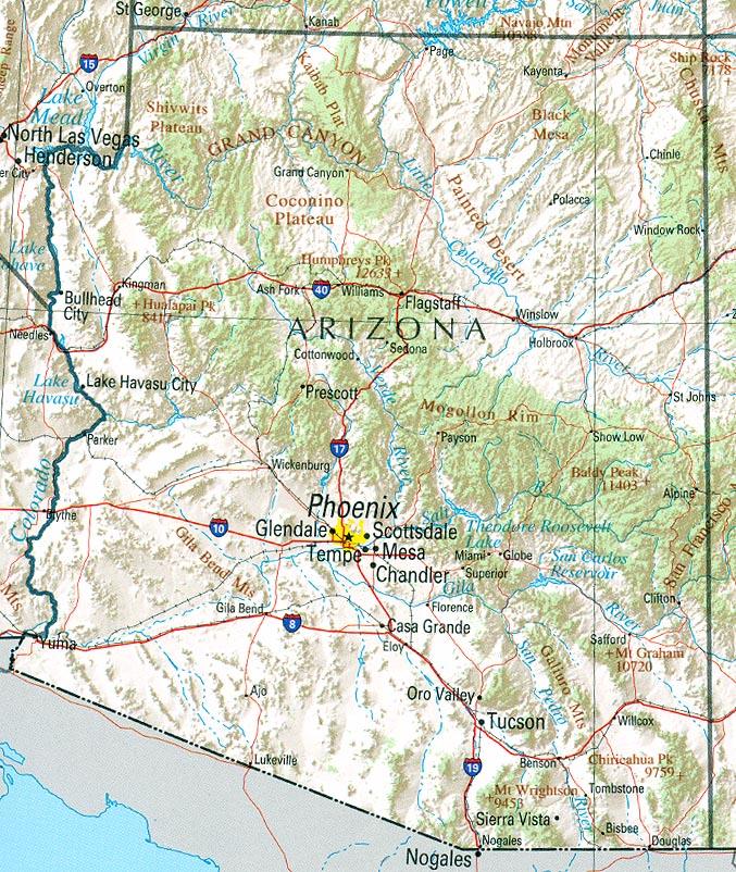
Colorado & Arizona
Sources of Data:


Geography 211: Cartography
Joseph CocoGenitti
Western United States
Colorado & Arizona
Sources of Data:
1900-1990
COLORADO: Population of
Counties by Decennial Census: 1900 to 1990
TXT file (saved as MS Word document)
ARIZONA: Population of Counties by Decennial Census: 1900 to 1990
TXT file (saved as MS Word document)
2000-2010
Census 2000 Data for the State of
Colorado (contains 2000 & 2010)
HTML file (saved as MS Excel document)
Census 2000 Data for the State of
Arizona (contains 2000 & 2010)
HTML file (saved as MS Excel document)
2015
Colorado
Counties by Population
HTML file (saved as MS Word document)
Arizona Counties by Population
HTML file (saved as MS Word document)
Information about States
Population Brief: Trends in the
Western US
Water and Population in the American
West
Western US Climate Historical
Summaries
Data Visualization: Western US
Demographics
Visualizing Environmental Trends: EcoWest

Subscribe to:
Comments (Atom)